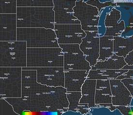
WEDNESDAY AM RADAR – FAST EAST LOADING RADAR
The Wednesday morning radar is completely clear of any sort of precipitation over any portion of the Plains …the Midwest …and the Delta regions. In fact the only significant precipitation is some moderate steady rain over the western third of Washington State.
TUESDAY MAX TEMPS
Temperatures were quite uniform across most areas in the Plains the Midwest and the Delta regions. Max temperatures stayed in the middle and upper 60s over the ECB … but all other areas of the Midwest as well as most of the Plains and all of Delta regions saw max temps in the 70s. There were some Low 80s over southwest third of KS… western OK …and western half of TX.
WEDNESDAY MIN TEMPS
Min temperatures on Wednesday morning were not as cold as Tuesday morning. For the most part readings were in upper 30s and low 40s over the ECB and eastern MT/ WY/ COL, western KS and western NEB. Readings were in the Middle and Upper 40s over the WCB, ND, SD, eastern NEB, MO, ARK, LA, MS, AL, eastern TX, eastern OK and eastern KS.
SUMMARY — NO MAJOR CHANGES IN 1-5D–6-10D–11-15D
1-5 DAY
Things look pretty quiet all the next 4 days with no significant precipitation showing up in many areas until D4-D5. The cool air mass which hit the Midwest and the eastern third of the country yesterday will be centered over the East Coast by this weekend. This will allow the surface winds to become more westerly and allow for moderate warming to take place over most of the Plains and Midwest as we move into the weekend.
At the same time a massive trough over Alaska and the Gulf of Alaska as well as western Canada will move into the Pacific Northwest by Friday. This system will move rapidly into the Plains and towards the Midwest over the weekend. At the surface this trough will have a fairly strong cold front which will bring moderate to significant rains of 0.5-2.5″/ 12-60mm with 60% coverage for eastern Texas and 60 to 70% coverage over Louisiana, Arkansas, eastern Oklahoma, most of Missouri as well as far southeastern Kansas. Additional but lighter rains will fall over the eastern half of Iowa… southern and central Missouri and the southern half of Wisconsin with amounts of 0.50-1.5″ with 50-60% coverage.
6-10 DAY
This Midwest cold front will reach the East Coast early next week and bring significant rain from Georgia into New England. For the Midwest however this will be another blast of seasonally cool air for late October. Many areas in the Midwest and over the central Plains which have not yet seen a frost will probably see one on the morning of the 24th or on the 25th. With respect to precipitation all areas will be tried for the entire 6-10D.
11-15 DAY
The overall pattern looks like it’s going to shift again with the development of a new trough in the Gulf of Alaska. This establishes a mean trough position over the far eastern Pacific and on the immediate US Coast. And this in turn will set up a RIDGE over the Plains …the Midwest …and allow temperatures to probably return to the above normal levels after the 31st and into the first several days of November.
For those interested in Grains, every Thursday, Sean Lusk, Director Walsh Commercial Hedging Services hosts a FREE Grain Outlook webinar. Sean will hold his next Grain Outlook webinar on Thursday, October 19th. REGISTER NOW. If you cannot attend live, a recording will be sent to your inbox upon sign-up. REGISTER NOW. If you missed last week’s webinar you may VIEW A RECORDING.