
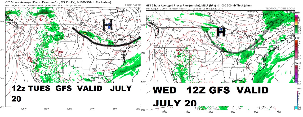
The 12z Wednesday operational GFS has now moved this High further south driving the front into southern Minnesota across Iowa into Illinois, Indiana and Kentucky … and with the front is rain over 50% of the WCB (0.50-1.5″/ 12-38mm) and 60-70% of the ECB in the 0.75 -2.5″ range.
see image
The movement of this front is going to be changing several times over the next several days. However with the change on the midday GFS model the trade is likely to react to this.
It must be kept in mind that this solution however is not necessarily the correct one and we still have several days to go regarding this front and whether or not it’s going to come South and protect the Midwest after July 20th.
The new 12z GFS ENSEMBLE has come out and it has the dome stronger the northern cold front weaker and a a LOT less rain over the Midwest … see image
For those interested in grains, Sean Lusk, Director, Walsh Commercial Hedging Services hosts a FREE Grain Outlook webinar each Thursday at 3PM CST. He will hold his next webinar on Thursday, July 13th. REGISTER NOW.